Arkansas Trail Intelligence: Where advanced AI meets outdoor adventure
Arkansas Trail Safety: A Technology Revolution
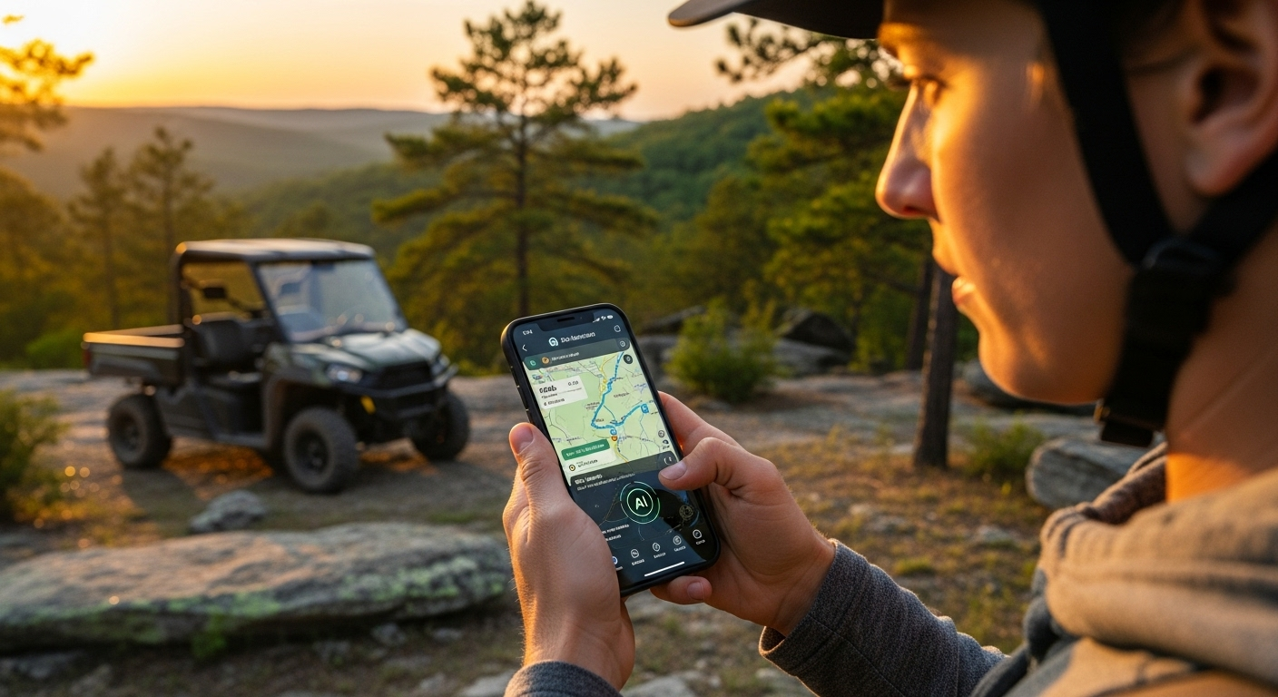
Arkansas Trail Intelligence represents a fundamental breakthrough in outdoor safety technology. Built by outdoor enthusiasts who got tired of getting lost with existing tools, our platform combines enterprise-grade artificial intelligence with specialized Arkansas terrain knowledge to create the most advanced trail navigation and emergency response system ever developed.
Unlike generic outdoor apps designed for casual hiking, Arkansas Trail Intelligence was purpose-built for the unique challenges of Arkansas wilderness. From the dense forests of the Ozark Mountains to the intricate waterways of the Arkansas Delta, our system understands the specific terrain, weather patterns, and safety challenges that define outdoor adventures in the Natural State.
What Makes Us Different
We're not another trail app. We're a comprehensive safety platform that works when you need it most - in remote areas with no cell coverage, during equipment failures, and in emergency situations where standard navigation tools become useless.
Understanding the Arkansas Challenge
Arkansas presents unique outdoor challenges that generic navigation apps simply can't handle. Our development team spent years analyzing these specific conditions to build targeted solutions:
Dense Forest Coverage
Arkansas's dense canopy interferes with GPS signals and creates confusing terrain where landmarks disappear. Our AI system compensates with advanced positioning algorithms and Arkansas-specific waypoint databases.
Rapidly Changing Water Levels
Arkansas waterways change dramatically with seasons and weather. Our platform integrates real-time water level data and predictive flooding models to provide accurate navigation in dynamic conditions.
Poor Cell Coverage
Remote Arkansas locations often have no cellular service. Our 100% offline capability ensures full functionality regardless of connectivity, with comprehensive offline maps and AI processing.
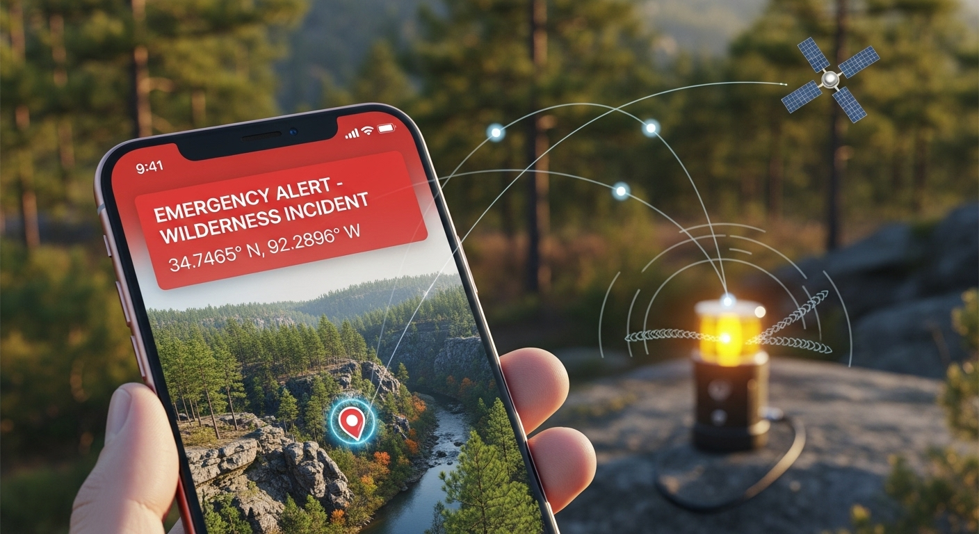
Advanced emergency response system designed specifically for Arkansas conditions
Enterprise-Grade AI Technology Stack
Arkansas Trail Intelligence leverages the same enterprise AI infrastructure that powers Kojie.works and BDM.consulting. This isn't hobbyist technology - it's production-grade AI designed for mission-critical applications.
Multi-AI Orchestration
Our platform simultaneously coordinates multiple AI models for different tasks:
- GPT-5 Engine: Natural language processing and complex reasoning
- Claude-4 Reasoning: Safety analysis and risk assessment
- Gemini Vision: Real-time terrain analysis and obstacle detection
- Specialized Arkansas Models: Custom-trained on Arkansas terrain data
AI Knowledge Chunks
Offline Processing
Response Time
Emergency Ready
This AI infrastructure provides intelligent recommendations for trail conditions, weather analysis, equipment needs, and route optimization. More importantly, it powers our emergency response system with the ability to analyze situations and provide actionable guidance when you're in trouble.
Emergency Response System
Critical Safety Features
Our emergency response system was designed based on real-world incidents and near-miss experiences. Every feature has been tested in actual emergency scenarios to ensure reliability when it matters most.
Panic-Proof Interface
Emergency buttons designed to work with cold, wet, or injured hands. Large targets, high contrast colors, and simple navigation that functions even when you're scared or exhausted.
Precision Location Sharing
Advanced GPS coordinate systems with multiple format outputs. Automatically generates location descriptions using Arkansas-specific landmarks and reference points for emergency services.
Pre-Written Emergency Messages
Template emergency messages for different scenarios. GPS coordinates and situation details automatically inserted. Works via SMS, email, or any available communication method.
Emergency Scenarios Covered
Our system provides specific guidance and response protocols for common Arkansas outdoor emergencies:
- Lost/Disoriented: Step-by-step navigation assistance and backtracking routes
- Equipment Failure: Alternative navigation methods and emergency procedures
- Weather Emergencies: Shelter locations and weather-specific safety protocols
- Injury Situations: First aid guidance and evacuation coordination
- Vehicle Breakdown: Repair resources and towing service contacts by location
Duck Hunting & Waterway Integration
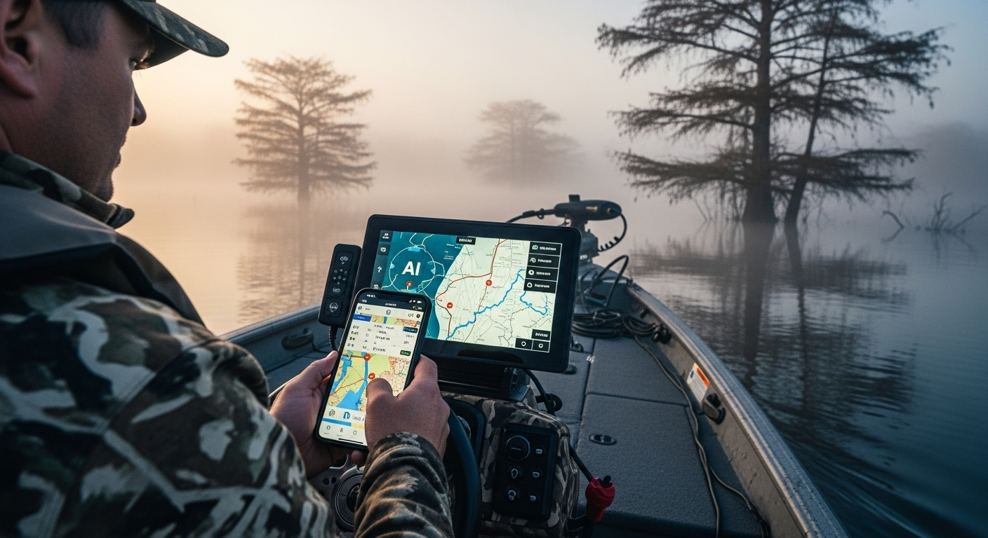
Revolutionary duck hunting navigation combining trail access with waterway intelligence
Arkansas Trail Intelligence is the first platform to seamlessly integrate trail riding with duck hunting access. We understand that many Arkansas outdoor enthusiasts combine these activities, using trails to reach hunting spots and waterway access points.
Waterway Intelligence Features
Access Point Discovery
- 263 boat ramps and water access points
- Trail connections to waterway access
- Seasonal availability tracking
- Depth and navigation hazard data
Hunting Integration
- Duck blind and hunting spot waypoints
- Arkansas hunting regulations knowledge
- WMA access and requirements
- Season-specific recommendations
Our AI system understands Arkansas hunting seasons, regulations, and access requirements. Ask about duck hunting opportunities, and it provides specific guidance on legal hunting areas, access methods, and current conditions - all integrated with the trail navigation system you already know.
"Finally, one platform that understands how Arkansas outdoors actually works. Trail riding to duck hunting spots shouldn't require three different apps." - Beta Tester Feedback
Kojie AI Voice Agent Integration
The same advanced voice technology that powers enterprise business applications at BDM.consulting has been specialized for Arkansas outdoor applications. Our voice agent understands outdoor terminology, Arkansas geography, and emergency situations.
Hands-Free Navigation
Voice commands for navigation while riding, driving, or when hands aren't available. Arkansas-specific voice recognition trained on local place names and outdoor terminology.
- "Navigate to Haw Creek Falls trail"
- "Find nearest emergency exit route"
- "What are trail conditions at Macks Pines?"
- "Emergency assistance - I'm lost"
Conversational Interface
Natural conversation about trails, conditions, and planning. Ask complex questions and receive detailed, contextual responses based on real-time data and Arkansas expertise.
Emergency Voice Commands
Critical emergency functions activated by voice when touch interface isn't possible. Designed to work in high-stress situations with natural, memorable commands.
Voice Agent Capabilities
Our voice agent integrates with the complete platform ecosystem:
- Real-time Trail Guidance: Turn-by-turn directions with Arkansas-specific landmarks
- Emergency Response: Immediate assistance protocols and emergency service coordination
- Condition Updates: Current weather, trail conditions, and safety recommendations
- Equipment Assistance: Gear recommendations and maintenance reminders
- Planning Support: Trip planning with AI-powered route optimization
Enterprise-Grade Architecture
Arkansas Trail Intelligence runs on the same enterprise infrastructure that powers Fortune 500 project management at Kojie.works. This isn't consumer-grade technology - it's enterprise-level reliability applied to outdoor safety.
Uptime SLA
Encryption
Response Time
Monitoring
Technical Infrastructure
Backend Architecture
- React 18 + TypeScript frontend
- Express.js backend with clustering
- PostgreSQL with Drizzle ORM
- TanStack Query for state management
- Advanced caching strategies
Security & Performance
- Session-based authentication
- Encrypted data storage
- Secure API endpoints
- Sub-second load times
- Progressive enhancement
The platform's Progressive Web App architecture provides native app performance with web app flexibility. Comprehensive service worker implementation ensures offline functionality, while intelligent data synchronization maintains consistency when connectivity returns.
Mission-Critical Design
Every component was designed with the understanding that system failures in remote Arkansas locations can have life-threatening consequences. Redundant systems, failover mechanisms, and graceful degradation ensure the platform works when you need it most.
Future Roadmap & Innovations
Arkansas Trail Intelligence continues evolving with cutting-edge technology and user feedback. Our roadmap includes revolutionary features that will further transform outdoor safety:
AR Trail Navigation (iPhone)
Augmented reality trail markers and waypoints overlaid on real-world camera views. Point your iPhone at the trail and see digital guidance integrated with the physical environment.
Satellite Emergency Communication
Direct satellite communication for true emergency situations. Send GPS coordinates and status updates from anywhere in Arkansas, regardless of cellular coverage.
Advanced AI Prediction
Machine learning models that predict trail conditions, weather impacts, and potential hazards based on historical data and current conditions.
Innovation Pipeline
- Community Integration: Social features for trail condition sharing and group coordination
- Equipment Monitoring: IoT integration for vehicle and equipment status monitoring
- Advanced Weather: Hyperlocal weather prediction using Arkansas-specific models
- Emergency Network: Mesh networking for group communication in remote areas
- Training Modules: Interactive safety training and emergency preparedness education
Conclusion: Technology That Actually Works
Arkansas Trail Intelligence isn't just another outdoor app - it's a comprehensive safety platform built by people who understand the real challenges of Arkansas wilderness. Every feature has been tested in actual field conditions, refined through real emergencies, and validated by users who depend on reliable technology for safety.
Why Choose Arkansas Trail Intelligence
- Built by Arkansas Riders: Created by people who actually ride Arkansas trails regularly
- Enterprise-Grade Reliability: Same infrastructure that powers Fortune 500 companies
- 100% Offline Capable: Works completely without cell service or internet connectivity
- Emergency-Tested: Features validated in real emergency situations
- Arkansas-Specific: Designed for the unique challenges of Arkansas terrain and conditions
- Continuously Evolving: Regular updates based on user feedback and technological advances
When you're 30 miles from cell service and something goes wrong, generic apps become useless. Arkansas Trail Intelligence was built for those moments - providing reliable navigation, emergency assistance, and intelligent guidance when you need it most.